Map shows what would happen to Gaza under the US ‘master plan’ | Israel-Palestine conflict News
At the World Economic Forum last week in Davos, Switzerland, Jared Kushner, a real estate developer and son-in-law of United States President Donald Trump, unveiled a “master plan” for post-war Gaza during a presentation.
The plan, which was contrived without any consultation with Palestinians in Gaza, promises to rebuild Gaza from scratch and includes residential towers, data centres, seaside resorts, parks, sports facilities and an airport.
“There is no Plan B,” said Kushner, as he unveiled the plan, accompanied by AI-generated images and a colour-coded map.
But a closer analysis of the proposal reveals a stark reality ignored by the glossy renders: The plan necessitates the total erasure of Gaza’s existing urban fabric.

The ‘Vegas-ification’ of Gaza
The project forms part of Trump’s push to advance the Gaza ceasefire, which Israel has violated on a daily basis, killing nearly 500 people since it came into effect.
“I’m a real estate person at heart, and it’s all about location,” Trump said about the development plan. “And I said, look at this location on the sea, look at this beautiful piece of property, what it could be for so many people.
“We’re committed to ensuring that Gaza is demilitarised, properly governed and beautifully rebuilt,” Trump added.
Kushner did not specify who would fund the redevelopment. “As you guys know, peace is a different deal than a business deal, because you’re changing a mindset,” he said, calling the Gaza peace efforts “very entrepreneurial”.
He added that the reconstruction plan would only commence following full disarmament by Hamas and the withdrawal of the Israeli military after that.

From an urban design perspective, this shift represents a radical change in the city’s identity. Ali A Alraouf, a professor of architecture and urbanism, describes this approach as the “Vegas-ification” of Gaza.
“The plan chases a visual image similar to Dubai or Las Vegas,” Alraouf notes, pointing to the rendering of glass towers and marinas. “Technically, this creates gated communities designed for a specific economic class, rather than an organic city fabric that serves the local population.”
Construction is expected to take two to three years, but no details were provided regarding housing for hundreds of thousands of displaced Palestinians during this period.
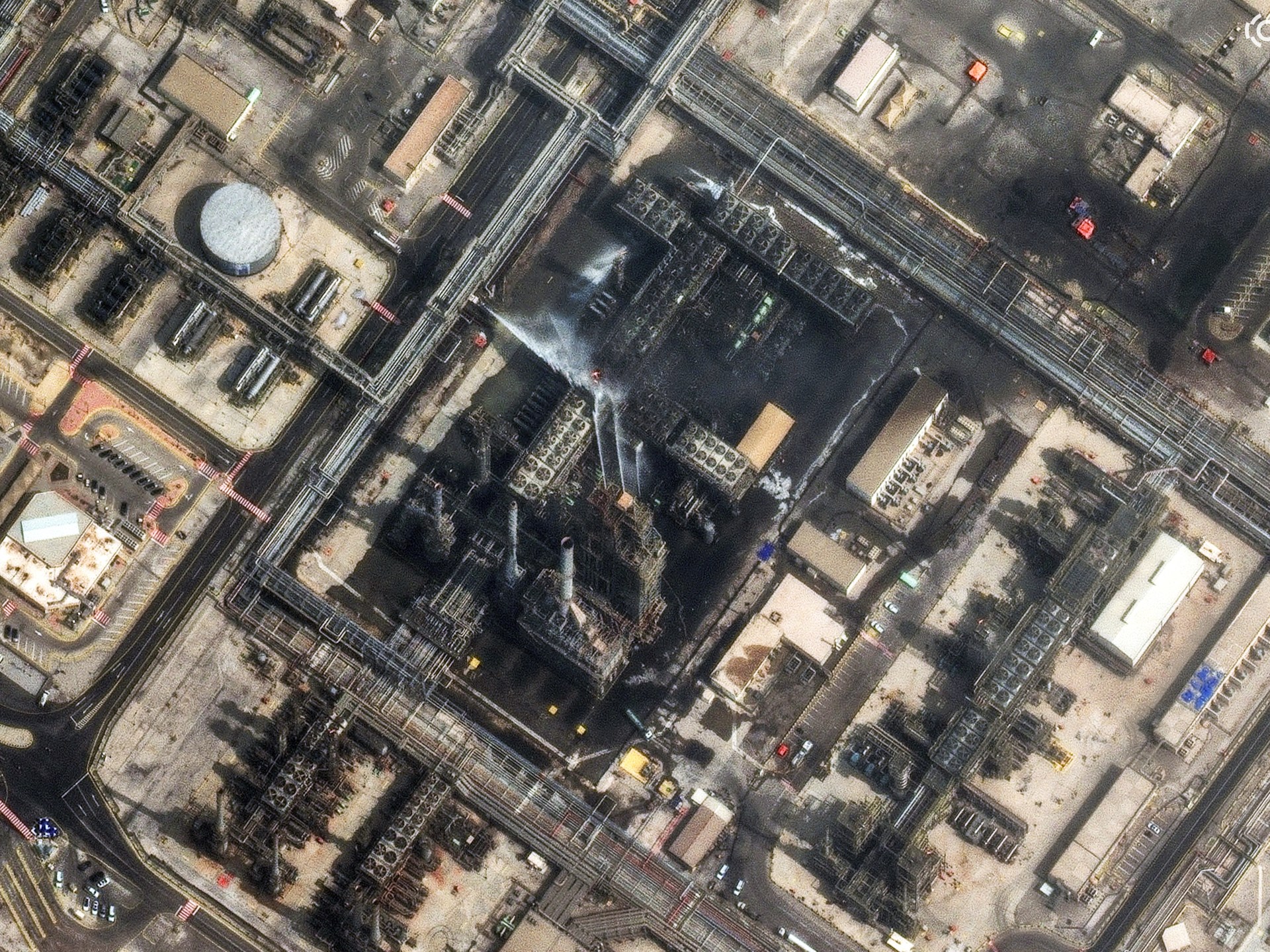
During more than two years of constant attacks on Gaza starting in October 2023, Israel, supported by the US, destroyed or damaged more than 80 percent of the buildings in the Strip, completely flattening many residential blocks.
Israel has also destroyed all major hospitals and universities, as well as most of the electricity and water systems, roads, and municipal services.
Israel’s genocidal war on Gaza has killed more than 71,000 Palestinians, with thousands more missing and presumed dead under the estimated 68 million tonnes of rubble.
Palestinians not consulted
Beyond the lofty promises, there were few details regarding the political future of Palestinians, with no mention of core issues such as property and land rights or a path to Palestinian statehood.
“Palestinians obviously have no voice whatsoever in this plan, there is no mention whatsoever of Israel, whether Israel will end its control and occupation of the Gaza Strip,” Tamer Qarmout, an associate professor in public policy at the Doha Institute for Graduate Studies, told Al Jazeera following the announcement.
Trump’s redevelopment plan shows how closely it is aligned with the needs of Israel’s occupation, according to analyst Sultan Barakat. “The whole idea of displacing the Palestinians, pushing them out from Gaza, has not ended,” Barakat told Al Jazeera.
History replaced by ‘data centres’
The “New Gaza” map presented by Kushner proposes the elimination of numerous existing neighbourhoods, historic sites and landmarks that are part of Gaza’s identity and history.
The plan assumes a flat, ready-to-build surface. However, engineering experts point out that building high-rises on such terrain is technically fraught.
“This is real estate fantasy rather than urban planning,” Alraouf argues. He suggests that from an engineering standpoint, the huge amount of debris might be repurposed not for reconstruction, but for terraforming, potentially using the rubble to reclaim land from the sea to create the artificial landscapes shown in the renderings.
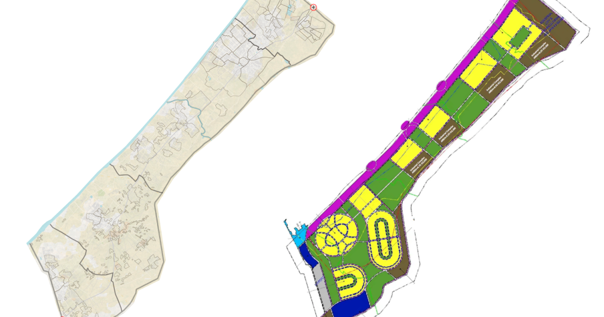
To better understand what this new plan would look like on the ground, we superimposed the newly proposed map onto a map of Gaza before Israel’s bombardment.
The map below shows which of Gaza’s neighbourhoods and famous landmarks would be transformed into “coastal tourism” areas, “industrial complexes”, “parks”, and “residential areas”.

Areas allocated for ‘coastal tourism’
- Shati refugee camp
- Most of Remal – This neighbourhood housed many high-rise buildings, including al-Shifa Hospital, the largest medical facility in the Gaza Strip. It also contained the Islamic University of Gaza, Al-Azhar University-Gaza, Al-Aqsa University, and various United Nations buildings.
- All of Deir el-Balah refugee camp
- Large parts of al-Mawasi

Areas allocated for ‘industrial complex, data centres and advanced manufacturing’
- All of Beit Hanoon
- Nearly all of Beit Lahiya – The once-thriving agricultural area, known especially for its plump strawberries that locals called “red gold”, has been systematically razed by Israeli bulldozers and heavy machinery, reducing fields to dirt.
- All of Gaza’s Old City – Home to several historic sites that date back more than 1,000 years, this area includes the Great Omari Mosque and two of Gaza’s churches: Saint Philip the Evangelist Chapel and Saint Porphyrius Church.
- Half of Shujayea and Zeitoun neighbourhoods – These are among the largest neighbourhoods in Gaza City, translating to “courage” and “olive,” respectively, from Arabic.

Areas allocated for ‘parks, agriculture and sports facilities’
- Most of Jabalia refugee camp – One of the largest refugee camps in the Strip that has been repeatedly attacked by Israel.
- Most of Daraj
- All of Maghazi refugee camp
- Barquq Castle
While the inclusion of green areas is usually viewed as a positive development, for Palestinians, particularly in the occupied West Bank, what are referred to as green areas or parks by Israel are often designated as military zones. For Palestinians, these spaces are heavily restricted, and Israel routinely governs access, allowing its forces to move in and out at will while significantly limiting Palestinian freedom.

Areas allocated for ‘residential areas’
- Large parts of Sheikh Radwan
- Most parts of Sabra and Tal al-Hawa
- Most of Nuseirat refugee camp
- Parts of al-Mawasi


Post Comment